A collaborative project between the UK and New Zealand is set to create an advanced earthquake and tsunami warning system.
The £750,000 joint research project will leverage underwater fibre optic cables to improve earthquake and tsunami warning capabilities, an innovation that could benefit millions worldwide.
The project could revolutionise ocean monitoring, providing coastal communities with extra time to prepare for devastating natural disasters.
The agreement will be announced at the OECD Committee for Scientific and Technological Policy Ministerial in Paris.
Additionally, the UK will also announce a partnership with Denmark at the OECD to combine efforts in quantum technology research and innovation.
UK Science Minister Andrew Griffith said: “Global issues require global collaboration, which is why we need to build more and stronger partnerships on science and research with like-minded nations, just like the ones I am delighted to announce with New Zealand and Denmark today.
“That shared endeavour is precisely what we will focus on with colleagues from across the OECD to ensure we can all benefit from the improvements to health and wealth that science and innovation promise to deliver.
“Bringing the UK and New Zealand’s brightest minds together to overhaul how we give crucial advance warning of tsunamis could save thousands of lives.
“This work proves the value of breakthrough technologies like quantum, and the international teamwork is crucial to harnessing them. The UK’s plans for closer work together on quantum with Denmark reinforces this even further.”
Why early tsunami warning systems are essential
Tsunamis, massive waves triggered by underwater earthquakes or landslides, pose a serious threat to coastal communities. Early tsunami warning systems are vital lifelines in these regions, offering precious time for evacuation and preparation.
Every minute gained is critical, as tsunamis can travel incredibly fast and strike with devastating force. The effectiveness of tsunami warning systems is undeniable.
Studies show a clear link between early warnings and reduced death tolls. In the aftermath of the 2004 Indian Ocean tsunami, for instance, regions with established warning systems fared significantly better.
Beyond saving lives, these systems also minimise property damage and economic loss. Timely evacuations allow people to move valuables and secure their homes. This translates to faster recovery and a smoother return to normalcy after the disaster.
The project will focus on evolving technology developed at the UK’s National Physical Laboratory (NPL) involving quantum systems.
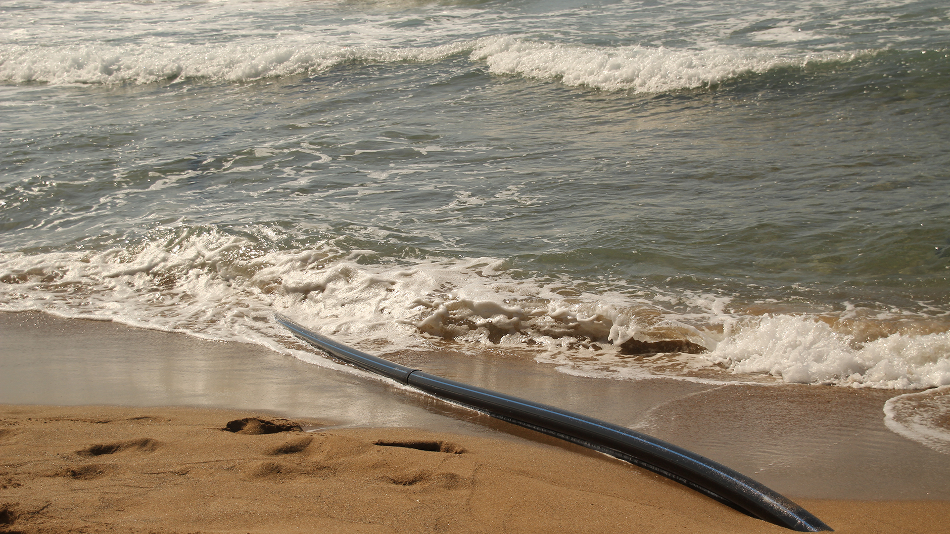
The technique utilises telecommunication fibre optic cables already installed in the seabed to detect earthquakes and ocean currents in a method known as optical interferometry.
The initiative will explore whether these cables can accurately provide an early tsunami warning to coastal communities when tremors occur.
The technology will be trialled between Australia and New Zealand in the Pacific Ocean – an area where earthquakes and tsunamis are common.
A previous study using a fibre optic cable running almost 6,000 kilometres from the UK to Canada demonstrated the technology’s success.
Investing in quantum research
Expanding its global quantum research network, the UK will also solidify its ties with Denmark in Paris through the signing of a Memorandum of Understanding (MoU).
Denmark’s prominence in quantum research makes it an ideal partner for the UK. Strengthening this collaboration will offer researchers from both nations optimal prospects to engage in groundbreaking projects, particularly in fields like transportation and life sciences.
Denmark Minister of Higher Education and Science, Christina Egelund, added: “The UK is a very attractive partner in the quantum field, with world-class research environments and great investments.
“With the new MoU, we are bringing Denmark’s quantum strategy to a higher international level. Quantum technology holds enormous potential to provide us with solutions in virtually every imaginable area, but it requires large investments and strong collaboration.
“For a small open economy such as Denmark, it is crucial to cooperate with the world’s leading countries. Both when it comes to talent exchange, research, innovation, commercialisation, security and defence.
“Therefore, I am very pleased that Denmark and the UK will now initiate an even closer collaboration on quantum technology.”
Professor Andrew Charlton-Perez, who led the study, said: “AI is transforming weather forecasting before our eyes. Two years ago, modern machine learning techniques were rarely being applied to make weather forecasts. Now we have multiple models that can produce ten-day global forecasts in minutes.
“There is a great deal we can learn about AI weather forecasts by stress-testing them on extreme events like Storm Ciarán. We can identify their strengths and weaknesses and guide the development of even better AI forecasting technology to help protect people and property.”
Comparing AI and physics-based forecasts
The scientists compared AI and physics-based weather forecasts for Storm Ciarán, which hit northern and central Europe in November 2023. The storm claimed 16 lives in northern Europe and left millions of homes without power in France.
The researchers used four AI models and compared their results with traditional physics-based models.
The AI models were able to predict the storm’s rapid intensification and track 48 hours in advance.
The AI weather forecasts were said to be indistinguishable from the performance of conventional forecasting models.
They also captured the large-scale atmospheric conditions that fuelled Ciarán’s explosive development, such as its position relative to the jet stream.
Underestimation of the storm
However, the machine learning technology underestimated the storm’s damaging winds.
All four AI forecasting systems underestimated Ciarán’s maximum wind speeds, which, in reality, gusted at speeds of up to 111 knots at Pointe du Raz, Brittany.
The team showed that the underestimation was linked to some of the storm’s features that the AI systems could not predict well.
Further investigation of the use of AI is needed
The researchers argue that further investigation of the use of AI in weather production is urgently needed to protect people from extreme weather events.
The development of machine learning models could mean that AI weather forecasts will be routinely used in the future, saving forecasters time and money.
RSS-Hydro discusses a prospective all-in-space solution that leverages high-resolution satellites to revolutionise disaster response and enhance global security for a more resilient future.
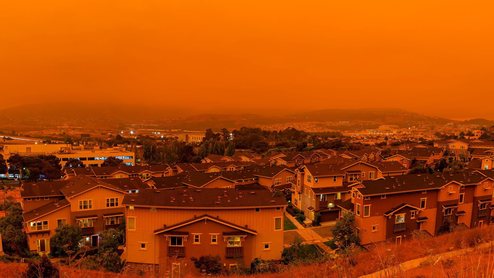
The Earth, a vibrant tapestry woven from diverse ecosystems, faces a growing threat from natural disasters.
From the fury of hurricanes and tsunamis, to the silent creep of droughts, and the destructive force of wildfires, these disasters disrupt lives, displace communities, and inflict massive economic damage.
While existing Earth Observation (EO) satellites offer valuable insights, their effectiveness is hampered by a silent enemy – latency.
The time it takes to process data and deliver actionable information to those on the ground can be the difference between a well-co-ordinated response and a desperate scramble for resources. This delay can prove catastrophic in critical situations, hindering rescue efforts, jeopardising lives, and amplifying the overall impact of the disaster.
Closing the latency gap: A high-tech network in space
Now, with all possible space technology, we could start thinking about an innovative all-in-space solution that tackles latency head-on by creating a comprehensive network of satellites orbiting Earth; a constellation of satellites around the planet, constantly gathering information.
These satellites are equipped with advanced sensors capable of capturing high-frequency, multispectral imagery, at high spatial resolution.
Unlike traditional single satellite missions, this approach creates a detailed picture of the situation below by capturing data across multiple spectrums. Imagine the ability to not only see flooded areas in high resolution but also to identify the depth and potential flow patterns based on radar and thermal data.
Additionally, radar sensors can penetrate cloud cover and debris, providing vital information during storms or landslides. This comprehensive data collection empowers near-real-time data acquisition – even in remote areas with limited infrastructure on the ground.
This constant stream of new or updated information information empowers a faster response, minimising the window of opportunity for disaster to wreak havoc.
Furthermore, the constellation design ensures frequent overpasses, increasing the likelihood of capturing critical data at the precise moment it’s needed.
Thinking outside the box: Onboard satellite processing
The all-in-space solution’s brilliance extends beyond data collection. It breaks new ground by performing initial processing and analysis directly onboard the satellites,1,2 effectively transforming them into mini-analysis centres in space. This concept, known as ‘onboard satellite constellation processing,’ eliminates the latency associated with transmitting raw data back to Earth for processing.
Consequently, the system can extract critical information and identify areas of concern much faster, providing decision-makers with near-real-time insights.
Imagine receiving immediate alerts about flood zones, wildfire trajectories, or potential landslides, accompanied by critical data points like estimated water depth or predicted fire spread. This empowers rapid mobilisation of resources, potentially saving lives and minimising property damage.
Additionally, onboard processing reduces the overall data volume that needs to be transmitted back to Earth, alleviating bandwidth limitations and further reducing latency.
Unlocking the secrets of big data: Space age supercomputers
The journey doesn’t end with onboard processing. The all-in-space solution could utilise powerful ‘orbital compute nodes’ – essentially supercomputers orbiting Earth. These nodes leverage cutting-edge machine learning algorithms to unlock the true potential of the vast amounts of EO data acquired by the satellites.
Picture these nodes as analytical powerhouses in space, sifting through mountains of data and uncovering hidden patterns. This allows for a deeper understanding of the situation on the ground, leading to targeted responses that minimise damage and save lives.
For example, the system could analyse historical fire data and weather patterns to predict the path of a wildfire with greater accuracy, allowing for targeted firebreaks and evacuations.
Additionally, by analysing historical flood data and terrain information, the system could identify areas at higher risk of landslides or more flooding, enabling preventative measures to be taken.
Seamless delivery: Putting information in the right hands
The solution doesn’t stop at analysis. Advanced data transmission protocols and secure communication networks ensure critical information reaches those who need it most.
Imagine a secure network delivering high-resolution images, flood maps, near real-time fire perimeters, and even potential landslide risk zones directly to the devices of disaster response teams. This empowers them to make informed decisions in the field and mobilise resources quickly and efficiently, saving lives.
A search and rescue team could co-ordinate their efforts based on real-time data on flooded areas and potential survivors trapped in debris. These secure networks could also be integrated with existing communication infrastructure, ensuring that critical information reaches not only disaster response personnel but also government agencies, humanitarian organisations, and even local communities.
This widespread dissemination of information fosters a collaborative approach to disaster response, maximising efforts and minimising losses.
Beyond disaster response: A broader impact for a safer world
The application of this technology extends far beyond flood mapping. This real-time, multi-sensor approach holds immense value for a wide range of civil security applications, such as real-time wildfire and deforestation monitoring, allowing for quicker intervention and environmental protection.
Early detection of forest fires, for example, can significantly reduce ecological damage and potential loss of biodiversity. Tracking illegal activity at sea or monitoring critical infrastructure can be significantly enhanced with constant surveillance from space.
This technology has the potential to revolutionise several critical areas:
Combating illegal activities
Illegal activities at sea, such as illegal fishing or human trafficking, could be significantly hampered. The ability to track vessels in real-time using a combination of optical and radar data would empower coast guards and law enforcement agencies to identify and intercept suspicious activity. This could significantly reduce illegal fishing practices, protecting marine ecosystems and ensuring sustainable fisheries.
Additionally, real-time monitoring of shipping lanes could be used to identify potential piracy threats, enhancing maritime security.
In fact, a number of new space companies and non-profit organisations are already developing services that use this type of technology in the marine surveillance sector.3, 4
Protecting critical infrastructure
Critical infrastructure, like pipelines, dams, and power grids, is vital for modern societies. This technology can be used to monitor these structures for potential hazards, allowing for preventative measures to be taken and potential disasters to be averted.
For example, high-resolution radar imagery can detect subtle changes in ground deformation, potentially indicating an impending landslide that could threaten a vital pipeline. Thermal data could be used to identify hotspots along power lines, allowing for targeted maintenance and preventing widespread outages.
Enhancing environmental monitoring
The real-time, multi-sensor data collected by this system can be invaluable for environmental monitoring efforts. Imagine being able to track deforestation activities in real-time, allowing for quicker intervention and stricter enforcement of environmental regulations.
Additionally, the system could be used to monitor natural resources like water levels in critical aquifers or track the health of coral reefs, providing valuable data for conservation efforts.
Promoting global security
The ability to monitor activity on a worldwide scale, particularly in remote or sensitive regions, has significant implications for international security. This technology could be used to track the movement of troops or military equipment, potentially deterring aggression and promoting peaceful conflict resolution.
Additionally, real-time monitoring of nuclear facilities could enhance international oversight and non-proliferation efforts.
The all-in-space-solution: Building a more resilient future
This all-in-space solution isn’t just about technology but ushering in a brighter tomorrow. By revolutionising disaster response, enhancing global security efforts, and promoting environmental sustainability, it has the potential to create a world where we are better prepared for emergencies, more proactive in protecting our planet, and more secure as a global community.
This innovative approach to an all-in-space solution is currently being actively explored by RSS-Hydro and its partners.
References
Mateo-Garcia, G., Veitch-Michaelis, J., Smith, L. et al. Towards global flood mapping onboard low cost satellites with machine learning. Sci Rep 11, 7249 (2021). https://doi.org/10.1038/s41598-021-86650-z
Nafiseh Ghasemi and Jon Alvarez Justo and Marco Celesti and Laurent Despoisse and Jens Nieke. Onboard Processing of Hyperspectral Imagery: Deep Learning Advancements, Methodologies, Challenges, and Emerging Trends. Image and Video Processing, eess.IV (2024). https://doi.org/10.48550/arXiv.2404.06526
Kroodsma, D.A., Hochberg, T., Davis, P.B. et al. Revealing the global longline fleet with satellite radar. Sci Rep 12, 21004 (2022). https://doi.org/10.1038/s41598-022-23688-7
Paolo, F.S., Kroodsma, D., Raynor, J. et al. Satellite mapping reveals extensive industrial activity at sea. Nature 625, 85–91 (2024). https://doi.org/10.1038/s41586-023-06825-8
Please note, this article will also appear in the 18th edition of our quarterly publication
Picture the minute hand at about 8 past the hour. That’s the slope of Viet’s backyard in southern Los Angeles County. It’s a bit too aggressive for a slip-and-slide. In fact, Viet doesn’t even let his 7-year-old daughter play on the family’s small back patio.
“I don’t need her falling down that hill,” he said.
When Viet and his wife bought their house-on-a-hill five years ago, it was a win, their piece of “the Hollywood Riviera,” as real estate agents like to call the area. (A self-employed marketer in his forties, Viet asked that his last name not be used to protect his family’s privacy.)
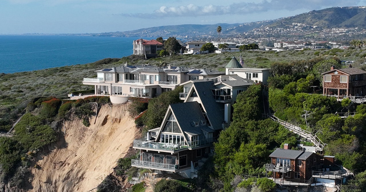
Viet’s street runs horizontally across a huge incline that begins the Palos Verdes Peninsula, a marvel of steep cliffs and Mediterranean-style homes at the south hook of Santa Monica Bay. If you squint, it could be the terraced hills of Tuscany or, indeed, a stretch of the Côte d’Azur. The address was a solid investment and housing insurance not a problem, even though parts of the peninsula have been known to shape-shift, cracking roads and knocking houses off foundations. But not every day. The family enjoyed some easy SoCal years on their perch with its great views and gentle, dry climate.
“Whenever it rained, we’d be happy: ‘We’re not in a severe drought anymore, yay!’” Viet said. “But after this, every time it rains, I get scared.”
“This” was the atmospheric river storms that hit LA with a one-two punch (the first, a jab, the second, a wallop) in the first week of February. The usual winter rainy season in California has been amped up this year by a parade of such storms. This week again, Santa Barbara, Ventura, and LA counties are in the midst of high-volume, road-cracking, flash-flooding, climate-amplified downpours juiced by warmer Pacific Ocean temperatures. The storms are causing an unusual amount of high-profile damage, setting everyone on edge, especially Viet.
After the initial rain burst on February 1, he noticed that the top of his backyard slope, swathed in a hand-high succulent called “ice plant,” looked odd. A patch of mushy soil seemed to be shrugging off its ground cover. He asked a gardener to try and fix it. That was a Friday. Then the monster rain cells moved in on Sunday, February 3.
“All night, all I could hear was pounding on the roof, the wind blowing sideways,” he said. “It was unsettling, so when I woke up at 7:30, the first thing I did was try to go look at the rain drains and make sure everything was doing fine.”
Viet circled his home in sneakers because he’d never had cause to buy rain boots.
“I walked around to the backyard, looked down, and I was like, ‘Ohhhhh myyyyyy goooood.’”
A 40-foot-wide river of mud, rock, and roots was in full flow down his hill, already jamming up a city road 70 feet below where Viet stood, somehow safe, on the precipice.
As climate change brings more natural disasters, the after-effects of those disasters must also be considered. RSS-Hydro discusses the effects of post-wildfire flooding, and what can be done to prepare for and mitigate the impact of those flooding waters.
Wildfires, the uncontrolled burning of vegetation, have become increasingly prevalent in recent years, leaving a trail of destruction in their wake. One of the most concerning consequences of wildfires is the heightened risk of post-fire flooding, a natural hazard that poses a significant threat to communities, infrastructure, and the environment.
Understanding the hazard: A landscape transformed
Post-fire flooding is linked to the profound alterations that wildfires inflict on the landscape. Removing vegetation, once a crucial shield against erosion and runoff, leaves the soil bare and exposed to the erosive power of rainwater. This can lead to the formation of a hydrophobic layer, a water-repellent film on the soil surface that further impedes water infiltration and increases surface runoff.
Flooding in burned areas, also known as post-wildfire flooding or flash flooding, is a natural hazard that can occur when wildfires remove vegetation, expose soil, and create a hydrophobic layer that prevents soil from absorbing water effectively. This can lead to a rapid increase in runoff, particularly during heavy rainfall events, which can cause flash floods, landslides, and erosion. In August 2023, Greece experienced devastating floods exacerbated by the previous year’s wildfires. A series of intense rainfall events triggered widespread flooding and mudslides in several regions, including Attica, Peloponnese, and the islands of Evia and Lesbos. These floods caused widespread damage to property and infrastructure, resulted in the loss of multiple lives, and displaced thousands of people. The floods were attributed to a combination of factors, including heavy rainfall, the impenetrable nature of burned soils, and wildfire debris. This event is a stark reminder of the significant threat posed by post-fire flooding and the importance of developing effective mitigation strategies.
The devastating impacts: A multifaceted threat
Post-fire flooding unleashes a cascade of destructive impacts, disrupting lives and ecosystems alike. Post-fire flooding is a natural hazard that can have devastating consequences. Wildfires can remove vegetation, expose soil, and create a hydrophobic layer that prevents soil from absorbing water effectively. This can lead to a rapid increase in runoff, particularly during heavy rainfall events, which can cause flash floods, landslides, and erosion. Flash floods and sudden and intense water surges carry debris and mud, wreaking havoc on property, infrastructure, and roads. The sheer force of these floods can endanger lives and disrupt transportation networks.
Landslides, another consequence of post-fire flooding, are triggered when heavy rainfall saturates the weakened and unstable soils, causing them to slide downhill. These landslides can occur at an alarming speed, posing a serious threat to communities residing in lower elevations. Erosion, the wearing away of land surfaces by water, is exacerbated by post-fire flooding. The rapid runoff of water dislodges soil particles, carrying them downstream and altering the flow of rivers and streams. This erosion damages waterways and degrades the land, disrupting natural habitats and ecosystems. In addition to these immediate impacts, ash concentrations can be mobilised in flood flows, contaminating drinking water supplies. This poses a significant threat to public health and can require extensive water treatment efforts to ensure safe drinking water.
Ash from wildfires can contain harmful substances, including heavy metals, arsenic, and polycyclic aromatic hydrocarbons (PAHs). When ash-contaminated floodwaters enter reservoirs, these contaminants can potentially migrate into drinking water supplies. Ash particles can also clog filters and interfere with water treatment processes, making it more difficult to remove harmful substances.
Exposure to ash-contaminated drinking water can pose a variety of health risks. Heavy metals can cause neurological, developmental, and reproductive problems. Arsenic can lead to cancer, skin diseases, and cardiovascular problems. PAHs can cause cancer, respiratory problems, and immune system damage. Mitigating the risk of post-fire flooding requires a comprehensive approach encompassing strategies to reduce the impact of wildfires and enhance the resilience of communities in burned areas.
Reducing the impact of wildfires: A preventive measure
Controlled burns, prescribed fire management, and forest thinning are effective strategies for reducing the severity of wildfires and their impact on the landscape. Controlled burns, conducted under controlled conditions, help to eliminate excess fuel and create firebreaks, reducing the risk of wildfires spreading uncontrollably. Prescribed fire management involves setting controlled fires at specific times and locations to reduce the overall fuel load in an area. Forest thinning, the selective removal of trees in dense forests, creates a more open landscape less susceptible to fire, reducing the risk of debris flows and erosion.
Enhancing community resilience: Building back stronger
The re-establishment of vegetation cover is crucial for restoring the natural protection against erosion and runoff. Revegetation efforts, involving planting trees, shrubs, and other plants in burned areas, help to improve soil infiltration and reduce the risk of flooding. Soil stabilisation techniques, such as using mulch, compost, and other materials to cover the soil, can further enhance soil infiltration and reduce the formation of hydrophobic layers. Early detection and suppression efforts, relying on an active wildfire monitoring network and rapid response teams, are critical in limiting the spread of wildfires and minimising the extent of burned areas.
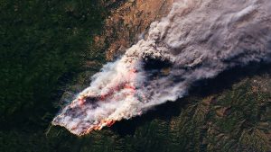
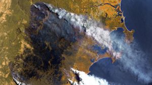
Satellites are playing an increasingly important role in wildfire monitoring and prediction. They can detect fires early, provide real-time information on their extent and intensity, and help firefighters predict how fires will spread. Such information can be complemented by on-the-ground sensor technology and hydrodynamic modelling, a powerful tool for simulating water flow and predicting flooding in burned landscapes. Such simulations provide valuable insights for land-use planning and infrastructure development. Satellite sensors can also provide real-time data on rainfall patterns, soil moisture, and vegetation cover. They can identify areas at high risk of flooding and trigger early warning systems and evacuation orders.
A call to action: Embracing sustainable practices
Addressing the growing threat of post-fire flooding requires a collective effort from individuals, communities, and governments. Adopting sustainable practices, such as reducing deforestation and implementing prescribed fire management, can help to reduce the risk of wildfires and their devastating consequences. Investing in early warning systems, flood mitigation infrastructure, and reforestation efforts can further enhance resilience and protect communities from the destructive forces of post-fire flooding.
As climate change continues exacerbating the frequency and intensity of wildfires, the need for effective mitigation strategies for post-fire flooding becomes increasingly urgent. By understanding the underlying causes of this hazard and exploring innovative solutions, we can work towards a future where communities are better prepared to face the challenges posed by post-fire flooding and safeguard lives, property, and the environment.
At RSS-Hydro, we research and develop innovative water risk management solutions that combine computer modelling and satellite Earth Observation technologies to help communities, governments and industry become more resilient and be better prepared when facing disaster.
Please note, this article will also appear in the seventeenth edition of our quarterly publication.