Tag: Climate Modelling

  • New open-source AI model for weather and climate applications

    New open-source AI model for weather and climate applications

    [ad_1]

    IBM has announced a new open-source AI model for a variety of weather and climate use cases that are available to the scientific, developer, and business communities.

    Developed by IBM and NASA, with contributions from Oak Ridge National Laboratory, the open-source AI model offers a flexible, scalable way to address a variety of challenges related to short-term weather and long-term climate projection.

    Because of its unique design and training regime, the weather and climate foundation model can tackle far more applications than existing weather models.

    Potential applications include creating targeted forecasts based on local observations, detecting and predicting severe weather patterns, improving the spatial resolution of global climate simulations, and improving how physical processes are represented in numerical weather and climate models.

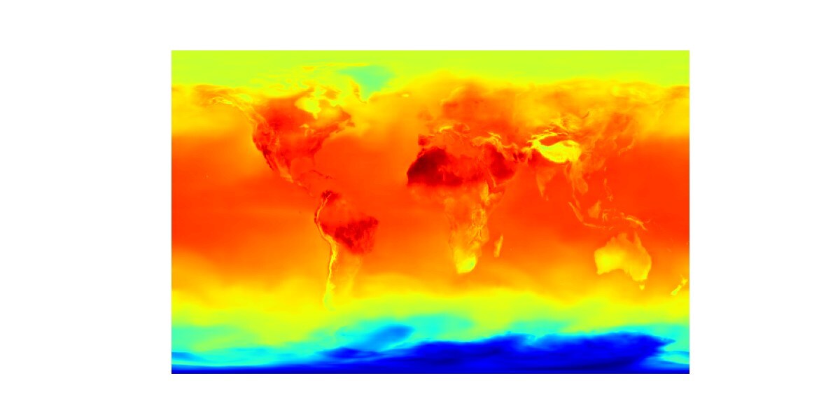
    How AI foundation models tackle pressing climate issues

    In one experiment, the open-source AI model accurately reconstructed global surface temperatures from a random sample of only 5% of original data, suggesting a broader application to problems in data assimilation.

    This model was pre-trained on 40 years of Earth observation data from NASA’s Modern-Era Retrospective Analysis for Research and Applications, Version 2 (MERRA-2).

    As a foundation model, its unique architecture allows it to be fine-tuned to global, regional, and local scales. This flexibility makes it suitable for a range of weather studies.

    The foundation model is available for download on Hugging Face, along with two fine-tuned versions of the model that tackle specific scientific and industry-relevant applications. These are:

    • Climate and weather data downscaling: A common meteorological practice is downscaling—inferring high-resolution outputs from low-resolution variables. Typical data inputs include temperature, precipitation, and surface winds, all of which can have varied resolutions.
    • Gravity wave parameterisation: Gravity waves are ubiquitous throughout the atmosphere and can affect many atmospheric processes related to climate and weather, such as cloud formation and aircraft turbulence. Traditionally, existing numerical climate models have not sufficiently captured gravity waves, which leads to uncertainties in terms of how exactly gravity waves can affect climate processes.

    Reaching beyond limitations

    Karen St Germain, director of the Earth Science Division of NASA’s Science Mission Directorate, stated: “Advancing NASA’s Earth science for the benefit of humanity means delivering actionable science in ways that are useful to people, organisations, and communities.

    “The NASA foundation model will help us produce a tool that people can use weather, seasonal, and climate projections to help inform decisions on how to prepare, respond, and mitigate.”

    Juan Bernabe-Moreno, Director of IBM Research Europe and IBM’s Accelerated Discovery Lead for Climate and Sustainability, added: “This space has seen the emergence of large open-source AI models that focus on a fixed dataset and single use case — primarily forecasting.

    “We have designed our weather and climate foundation model to go beyond such limitations so that it can be tuned to a variety of inputs and uses.”

    Testing the flexibility of the model

    IBM has already collaborated with Environment and Climate Change Canada (ECCC) to test the flexibility of the open-source AI model with additional weather forecasting use cases.

    With the model, ECCC is exploring very short-term precipitation forecasts using a technique called precipitation nowcasting that ingests real-time radar data as input.

    The team is also testing the downscaling approach from global model forecasts at 15 km to km-scale resolution.

    This weather and climate model is part of a larger collaboration between IBM Research and NASA to use AI technology to explore our planet, and joins the Prithvi family of AI foundation models.

    [ad_2]

    Source link

  • Antarctic ice melt to cause catastrophic sea-level rise by 2300

    Antarctic ice melt to cause catastrophic sea-level rise by 2300

    [ad_1]

    A major study led by Dartmouth College researchers, involving over 50 climate scientists, has revealed alarming long-term projections about Antarctica’s ice sheet and its potential collapse due to carbon emissions.

    The research highlights the risk of significant sea-level rise caused by Antarctic ice melt beyond 2100 if current emission levels continue.

    The findings provide a crucial long-term perspective, predicting a rapid retreat of Antarctica’s glaciers after the 21st century.

    Gradual Antarctic ice loss through 2100, then rapid acceleration

    The research shows that Antarctica’s ice sheet will lose mass gradually throughout the 21st century. The study used data from 16 ice-sheet models, which collectively show a slow but steady increase in Antarctic ice loss through 2100. However, the models diverge significantly when projecting ice loss after 2100.

    Beyond this point, the situation worsens dramatically. If current carbon emissions continue unchecked, glaciers in western Antarctica could retreat rapidly by 2200, raising global sea levels by as much as 5.5 feet. By 2300, the study even suggests the near-total collapse of Antarctica’s ice sheet is possible.

    Hélène Seroussi, the study’s lead author and associate professor at Dartmouth’s Thayer School of Engineering, emphasised the lack of focus on long-term sea-level rise in climate discussions.

    “When you talk to policymakers, they mostly focus on what will happen up to 2100,” Seroussi explained. “Our study provides longer-term projections that have been lacking. Beyond 2100, the long-term impact for the regions most susceptible to sea-level rise become amplified.”

    The role of carbon emissions in ice sheet melting

    The study compared Antarctica’s ice sheet under both high- and low-emission scenarios. The difference in sea-level rise between these two scenarios becomes far more pronounced after 2100.

    Under high-emission scenarios, ice-sheet models predict irreversible ice loss in several basins in western Antarctica. These regions are particularly vulnerable to collapse, which would cause rapid and unstoppable melting.

    Mathieu Morlighem, a Dartmouth professor and co-author of the study, stressed the importance of cutting carbon emissions now to prevent a disastrous future.

    “While current carbon emissions have a modest impact on projections for this century, the difference between high- and low-emission scenarios becomes critical after 2100,” Morlighem said. ” These results confirm that it is critical to cut carbon emissions now to protect future generations.”

    While the exact timing of these glacier retreats varied between models, the rapid pace of ice loss once initiated was consistent. Seroussi warned that once the retreat begins, “nothing can stop or slow it down,” signalling that immediate action is required to prevent irreversible damage.

    Cutting emissions to save Antarctica

    The study serves as a powerful call to action, highlighting the need for global efforts to reduce carbon emissions.

    Although the most severe impacts of Antarctic ice melt are projected beyond 2100, the groundwork for these outcomes is being laid today. The researchers urge policymakers and global leaders to act swiftly to prevent the worst-case scenarios.

    This research highlights the importance of global scientific collaboration. By combining multiple ice-sheet models, the study provides a clearer picture of Antarctica’s ice sheet future and where uncertainties still exist.

    Seroussi hopes this collaboration will continue, allowing scientists to refine their models and focus on areas with the greatest uncertainties, including Greenland’s ice sheet.

    As Antarctica’s ice sheet continues to melt, its effects will ripple across the globe, making immediate action essential.

    [ad_2]

    Source link

  • Why green spaces are key to combating heat in Global South

    Why green spaces are key to combating heat in Global South

    [ad_1]

    New research reveals that cities in the Global South are increasingly vulnerable to extreme heat due to a significant lack of cooling green spaces.

    This disparity, when compared to cities in the Global North, highlights a pressing need for urban greening strategies to combat the escalating threat of heat-related illnesses and deaths.

    Cooling disparities between Global North and South

    The study, conducted by an international team including researchers from Nanjing, Exeter, Aarhus, and North Carolina State universities, found that cities in the Global South have only 70% of the ‘cooling capacity’ provided by urban green spaces compared to their counterparts in the Global North.

    This difference is starkly evident as temperatures rise globally and urban heat island effects intensify, making cities significantly hotter than surrounding rural areas.

    Professor Tim Lenton of the Global Systems Institute at the University of Exeter emphasises the importance of urban green spaces, noting: “Urban greenery is a really effective way of tackling what can be fatal effects of extreme heat and humidity.

    “Our analysis suggests green spaces can cool the surface temperature in the average city by about 3°C during warm seasons – a vital difference during extreme heat.”

    The environmental benefits of green spaces

    Urban green spaces, such as parks, urban forests, and rooftop gardens, play a crucial role in cooling cities through shading and transpirational cooling—the process of water evaporation from plants.

    These spaces not only lower surface temperatures but also contribute to better air quality, reduced energy consumption, and enhanced biodiversity. In the face of climate change, the environmental benefits of green spaces extend beyond temperature regulation.

    ©shutterstock/anek.soowannaphoom

    They serve as carbon sinks, sequestering CO2 and helping to mitigate urban pollution. Green spaces also foster resilience against flooding by absorbing rainfall, thus reducing the strain on urban drainage systems.

    A global need for urban greening

    The study’s findings, based on satellite data from the world’s 500 largest cities, underscore a vast potential to enhance urban cooling in the Global South and address growing inequality.

    All of the top ten cities for cooling capacity are in the United States, with Charlotte and Raleigh-Durham leading the list. In contrast, Mogadishu in Somalia ranks lowest, followed closely by Sana’a in Yemen and Rosario in Argentina.

    The analysis also revealed that the average resident in the Global South experiences a cooling benefit of just 2.2°C from urban greenery, compared to 3.4°C for residents in the Global North.

    This disparity is largely due to the quantity and management of vegetation, as well as differences in tree species.

    Professor Jens-Christian Svenning of Aarhus University added: “The good news is that this nature-based solution to cooling can be substantially improved across the Global South, helping to tackle future heat stress for billions of people.”

    Future targets

    Re-greening cities, particularly in the Global South, will be challenging and costly in the short term, but it is essential for making urban areas liveable in the face of climate change.

    Potential solutions include expanding ground-level green spaces, implementing vertical and rooftop gardens, and protecting existing greenery from further loss.

    As cities grapple with rising temperatures, green spaces emerge as a critical tool for not only reducing heat but also enhancing the overall environmental health and sustainability of urban areas.

    Investing in these natural cooling systems is imperative for safeguarding the well-being of millions in the Global South.

    [ad_2]

    Source link

  • Study reveals hidden triggers of global water scarcity

    Study reveals hidden triggers of global water scarcity

    [ad_1]

    Securing the world’s water supply is rapidly becoming one of the most critical challenges of our time.

    Recent research conducted at Stockholm University has unveiled a new approach to quantifying the global risk of water scarcity, revealing that the situation may be far more precarious than previously thought.

    This study introduces a novel perspective that considers the environmental conditions and governance of the regions where rain is produced, offering a deeper understanding of the risks to global water security.

    Rethinking the global water supply

    Traditionally, the assessment of global water supply has focused on rainfall that accumulates on the Earth’s surface, replenishing aquifers, lakes, and rivers.

    This conventional approach has informed water security assessments and predictions of water scarcity. However, the new study suggests that this view might be too narrow.

    Fernando Jaramillo, an associate professor in physical geography at Stockholm University and one of the leading researchers of the study, points out that water supply does not merely start with the rain falling on the ground.

    Instead, it begins much earlier with moisture that evaporates from land or ocean surfaces, travelling through the atmosphere before eventually falling as rain.

    This ‘upwind’ moisture source has often been overlooked in traditional water availability assessments, yet it plays a crucial role in understanding global water scarcity risks.

    The importance of the precipitationshed

    Jaramillo’s research emphasises the importance of also considering an upwind perspective—specifically, the areas where evaporated water is transported before it precipitates as rain.

    These areas, known as ‘precipitationsheds,’ can span vast portions of the Earth’s surface and are critical to understanding the full picture of water availability.

    An illustrative example of this interdependence can be found in tropical South America. The Amazon basin, which lies downstream of the Andes mountain range, is highly dependent on the moisture evaporated from the Amazon rainforest itself.

    In turn, large portions of the Andes rely on this moisture, highlighting a complex relationship between these regions that directly affects their water supply.

    Increased risks and the role of governance

    The study analysed 379 hydrological basins around the world and found that the risks to water security increase significantly when the upwind origins of water are considered.

    José Posada, the study’s main author and former doctoral student at Stockholm University, noted that with this new approach, approximately 32,900 km³ of water requirements globally face very high risk—a nearly 50% increase compared to the traditional upstream-focused assessments.

    This increase in risk underscores the critical role that political control and environmental management play in securing water supplies.

    For example, land-use changes such as deforestation and agricultural expansion in upwind areas can drastically reduce the amount of moisture vegetation provides, leading to decreased rainfall and heightened water scarcity downstream.

    Countries like Niger, which rely heavily on moisture from neighbouring countries, are particularly vulnerable to these changes.

    The findings of this study underscore the necessity of adopting an upwind perspective in water governance and international cooperation.

    Environmental regulation in areas where moisture originates is crucial for maintaining water security in downwind regions. The study highlights the interconnectedness of water systems and the importance of cooperative management across borders.

    Jaramillo added: “We hope that the findings of this study can help identify where and to whom cooperation strategies and efforts can be directed to mitigate the causes of water-related tensions, including atmospheric water flows in transboundary decision-making and water governance frameworks.

    “We stress the need for international cooperation to effectively manage upwind moisture sources.”

    This research advocates for an urgent reevaluation of global water governance frameworks to include upwind moisture sources, fostering collaboration among nations to mitigate the growing risks of water scarcity.

    [ad_2]

    Source link

  • UK to receive earlier flood and drought warnings

    UK to receive earlier flood and drought warnings

    [ad_1]

    Researchers across the UK will use the latest tech and major data banks to provide better flood and drought warnings.

    Science and Technology Secretary Peter Kyle has announced that a new project for scientists using the latest tech and real-time data will make it easier to predict where future flooding and droughts will strike in the UK.

    It will help key bodies, such as local authorities and the Environment Agency, stem the worst of extreme weather’s impact on communities.

    This will save lives, homes, and businesses and help to cut the devastating cost of such events to the UK economy, estimated at £740m a year.

    The Floods and Droughts Research Infrastructure will be the first UK-wide network focused on understanding the impact of extreme weather conditions across the country, pinpointing where incidents are likely to occur and planning to limit their impact.

    Making flood and drought warnings more accurate

    The complexity of Earth’s climate makes rolling out flood and drought warnings a major challenge, and climate change only further complicates the situation.

    Researchers will use the latest technologies, including sensors and real-time computer monitoring, plus a huge bank of data, including river profiles, and near real-time monitoring of information on atmospherics, ground saturation, water movement, abstraction, and storage.

    Taken together, this will form a clearer impression of where and when extreme weather will strike.

    Science and Technology Secretary Peter Kyle said: “Flooding and droughts can devastate UK communities, from leaving people stranded to destroying homes, gardens, roads and businesses, and even claiming lives.

    “This project will help drive progress, with dedicated teams using the most advanced tech to crunch data gathered from our rivers and paint a clear picture of its likely impact – using the power of science and tech to keep the public safe.”

    Making the UK a leading force in disaster response

    Floods wreak havoc on communities by destroying homes, public infrastructure, and livelihoods like farming, which in turn costs consumers.

    Similarly, droughts have a major impact on the water supply and the UK ecosystem, harming wildlife and their natural habitats, which rely on regular rainfall.

    Researchers will be based at the UK Centre for Ecology & Hydrology’s offices throughout Great Britain, with further input from researchers at the British Geological Survey, University of Bristol, and Imperial College London.

    Findings from the project will be shared with key bodies like the Environment Agency to steer the UK’s response to extreme weather. It will also act as a hub for researchers to pursue new innovations, with discoveries shared worldwide, and mark the UK as a leader in the field.

    Floods Minister Emma Hardy concluded: “In the case of extreme flooding and drought, preparation and prediction are everything.

    “Our new institute will bring together a team of world-leading researchers and the latest technology to ensure our communities, businesses and farms are protected from these devastating events.”

    [ad_2]

    Source link

  • Scientists develop cutting-edge model to predict flash flooding

    Scientists develop cutting-edge model to predict flash flooding

    [ad_1]

    Flash flooding, one of the most dangerous natural disasters, has long posed a significant threat to communities around the globe.

    Now, a groundbreaking study led by an international team of climate scientists promises to transform our ability to predict these life-threatening extreme weather events more accurately, offering a crucial window of time for communities to prepare and mitigate damage.

    Researchers from the Met Office and Newcastle University, in collaboration with the Universidad de Costa Rica and Adam Mickiewicz University in Poland, have unveiled a new approach to predicting extreme rainfall—a key driver of flash flooding.

    The research reveals that intense, localised downpours are often triggered by a rapid rise of air through clouds, a process that can now be forecast with greater precision.

    The study marks a significant departure from previous methods, thanks to a cutting-edge modelling system that accurately identifies the atmospheric conditions leading to short-duration, heavy rainfall events.

    This new model could enhance early warning systems for flooding, providing essential lead time for communities vulnerable to extreme weather.

    The dangers of flash flooding

    Flash flooding poses a significant and immediate threat to life and property, often occurring with little to no warning.

    These events can transform a calm river into a deadly torrent within minutes, catching people off guard and leading to tragic consequences.

    Recent incidents, such as the catastrophic flash flooding in London in August 2022, highlight the urgent need for better prediction and preparedness.

    ©shutterstock/muratart

    In 2004, the village of Boscastle in Cornwall, UK, was devastated by a flash flood that saw 75 cars washed away and millions of pounds in damage.

    These examples underscore the importance of timely and accurate warnings in preventing loss of life and reducing the economic toll of such disasters.

    The science behind the model

    At the heart of this breakthrough is the discovery of a unique three-layered atmospheric structure crucial to understanding and predicting extreme rainfall.

    According to Paul Davies, the study’s lead author and a Met Office Principal Fellow, this structure consists of Moist Absolute Unstable Layers (MAULs) sandwiched between a stable upper layer and a near-stable lower layer.

    This finding represents a ‘paradigm shift’ in our understanding of how extreme rainfall events develop.

    By focusing on the thermodynamics of sub-hourly rainfall production, the research team has identified key atmospheric properties that can help forecasters predict these events with greater accuracy, potentially saving lives in the process.

    Davies believes the model will have significant impacts in the UK and globally: “The new model is aimed at enhancing the UK’s resilience to extreme weather events, which are becoming more frequent and intense due to climate change.

    “This approach addresses the urgent need for improved prediction capabilities and will help both UK and global communities in mitigating the risks associated with increasingly extreme weather events.”

    The need for accurate flash flooding early warning systems

    As climate change continues to exacerbate the frequency and intensity of extreme weather events, the importance of accurate early warning systems cannot be overstated.

    Professor Hayley Fowler, a co-author of the study and an expert on climate change impacts at Newcastle University, emphasised the critical need for these systems, particularly in light of the United Nations’ call for ‘Early Warnings for All’ by 2027.

    “With human-induced climate change leading to more extreme weather conditions, the need for accurate early warning systems is more critical now than ever before,” Fowler stated.

    The new model developed by the research team has the potential to become an operational system that aligns with the UN’s goals, helping to deliver timely warnings to vulnerable populations worldwide.

    Implementing new warning systems

    The innovative model developed by the research team could revolutionise how we approach flash flood warnings.

    By improving our understanding of the atmospheric conditions that lead to extreme rainfall, this new system can enhance the accuracy of forecasts, giving communities more time to take action.

    The potential benefits are clear: better prediction of flash flooding could lead to more lives saved, less damage to infrastructure, and greater overall resilience to extreme weather events.

    As climate change continues to influence weather patterns, the adoption of such advanced forecasting tools will be crucial in protecting communities from the increasing threat of flash flooding.

    [ad_2]

    Source link

  • Research shows which climate policy measures cut emissions

    Research shows which climate policy measures cut emissions

    [ad_1]

    A comprehensive analysis of thousands of climate policy measures worldwide has revealed that only a fraction are effective in reducing emissions.

    The study, led by researchers from the Potsdam Institute for Climate Impact Research (PIK) and the Mercator Research Institute on Global Commons and Climate Change (MCC), offers critical insights into which climate policies effectively reduce carbon emissions.

    In collaboration with experts from the University of Oxford, the University of Victoria, and the Organisation for Economic Co-operation and Development (OECD), the study evaluates a broad range of policy measures, going beyond the limited scope of previous evaluations.

    The importance of policy mixes in climate action

    Over the past two decades, thousands of climate policies have been implemented worldwide, yet there is little consensus on which are most effective.

    This new study fills that gap by analysing a wide variety of climate policies across different sectors, including building, electricity, industry, and transportation, in both industrialised and developing countries.

    Lead author Nicolas Koch from PIK and MCC emphasises that simply increasing the number of policies does not necessarily lead to better outcomes.

    Instead, the study reveals that the right mix of complementary climate policy instruments is crucial. For example, while subsidies or regulations alone may not be sufficient to drive significant emission reductions, their effectiveness can be greatly enhanced when combined with price-based instruments such as carbon and energy taxes.

    Comprehensive analysis of global climate policies

    The study embarked on a detailed analysis of 1,500 climate policy interventions implemented between 1998 and 2022.

    This analysis leverages the most comprehensive global inventory of climate policies available, alongside advanced statistical techniques, to assess the real-world impact of these policies on emissions.

    Among the 1,500 policies examined, only 63 were found to have significantly reduced emissions, with reductions ranging from 0.6 billion to 1.8 billion tonnes of CO2.

    These findings underscore the importance of using a mix of climate policy instruments to achieve substantial emission reductions.

    Contrary to some claims, the study demonstrates that effective policy combinations are not redundant but are essential in addressing different market failures.

    Pricing mechanisms, for instance, have proven particularly effective in the industry and electricity sectors, while a combination of incentives and regulations works better in the building and transportation sectors.

    Sector-specific insights and challenges in developing countries

    The study also highlights the varying effectiveness of policy instruments across different sectors and regions.

    In industrialised countries, pricing mechanisms have been highly successful in reducing emissions. However, in developing nations, regulatory and subsidy measures often need to precede or complement pricing mechanisms to be effective.

    This nuance is crucial for designing climate policies that are tailored to the specific economic and developmental contexts of different countries.

    Lead author Annika Stechemesser from PIK acknowledges the complexity of disentangling the effects of individual measures within a policy mix.

    Nevertheless, the study’s 63 success stories provide valuable insights into how well-designed climate policy combinations can be tailored to specific sectors and development levels. This knowledge is essential for supporting policymakers in their efforts to transition toward climate neutrality.

    Climate Policy Explorer: A tool for policymakers

    To make these findings accessible and actionable, the study’s results are available through an interactive online tool called the ‘Climate Policy Explorer.’

    This platform offers detailed insights into specific countries, sectors, and policy measures, allowing users to explore successful climate policy combinations in different contexts.

    For example, the UK’s success in reducing emissions in the electricity sector, driven by a minimum carbon price and a coal phase-out plan, serves as a notable example of effective policy design.

    Similarly, the US transportation sector’s emission reductions, achieved through a mix of tax incentives for low-emission vehicles and CO2 efficiency standards, demonstrate the importance of coordinated policy efforts.

    These insights are crucial for policymakers worldwide as they design and implement strategies to meet the Paris Agreement’s climate targets.

    The Climate Policy Explorer provides a comprehensive overview of the study’s findings, offering a valuable resource for those seeking to understand and apply effective climate policy combinations.

    [ad_2]

    Source link

  • UK Space Agency funds £2.5m for satellite data pilot projects

    UK Space Agency funds £2.5m for satellite data pilot projects

    [ad_1]

    Ten satellite data projects have been awarded £2.5 million as part of the UK Space Agency’s Unlocking Space for Business programme.

    The pilot projects, which have been awarded grants of up to £400,000 each, will trial new solutions that use satellite data and services to support transport, logistics and financial services.

    The trials will combine terrestrial data and technology (such as AI, quantum, machine learning, and geospatial data) with satellite data and services, providing deeper analysis to develop insights and present new solutions to UK customers.

    DSIT Minister for Data Protection and Telecoms, Chris Byrant, said: “We have a fast-growing space sector in the UK, but for too long, we have struggled to tap the huge potential of satellite data to drive positive change in the real world.

    “These new projects seek to unlock this potential by combining data from space with cutting-edge technologies here on Earth.”

    Reducing congestion with satellite data

    One project with Sports City Management Company aims to enhance visitor travel to the Etihad Campus, which is home to Manchester City’s Etihad Stadium and the new Co-op Live arena, by reducing congestion and increasing the sustainability of fan travel.

    The project will support the development of an AI-enabled travel demand solution. It will use satellite data from the European Space Agency’s Copernicus Open Access Hub and Sentinel satellites to predict patterns in the travel of music and sports fans at major events.

    Coupled with machine learning, this provides transport operators and event planners with insight into congestion points, public transport requirements and crowd flow.

    This will be tested in partnership with Transport for Greater Manchester (TfGM).

    Earth observation for climate monitoring

    Elsewhere, Octopus Investments has partnered with Treeconomy, a company that uses AI and remote sensing to measure the impact of nature restoration projects.

    This project will use a variety of satellite-based Earth observation data sources, including Landsat and Sentinel-2, as well as AI and localised drone-based data, to support the monitoring and evaluation of nature projects and a suite of core environmental metrics to inform investment decisions.

    This will increase confidence and improve the allocation of private finance towards high-quality, measurable and trusted nature and conservation efforts.

    Driving benefits for businesses through satellite data

    Unlocking Space for Business is delivered by the UK Space Agency to foster innovation by combining satellite data and services with other data sources and technology to drive benefits for businesses.

    This could include new revenue growth, operational efficiencies and environmental, social and governance (ESG) benefits.

    In addition to the grants, Unlocking Space for Business has provided exploration workshops, networking events, learning and development sessions, and online resources to support companies in their understanding of what satellite data and services can mean for them.

    They run alongside Contracts for Innovation, formerly the Small Business Research Initiative (SBRI), which supports the development of new ideas and technologies.

    “These new grants and contracts are just some of the ways the UK Space Agency is kickstarting growth and creating high-quality jobs to position the UK as a leading space economy,” explained Dr Craig Brown, Investment Director at the UK Space Agency.

    “Unlocking Space for Business is set up to identify and help tackle barriers facing organisations that have not traditionally used satellite data or services or considered how space can benefit their bottom line.”

    He added: “From AI-powered satellite-derived climate models to maritime incident avoidance and easier football fan travel, these projects will help accelerate innovation and investment and showcase the untapped potential of space data to support a range of UK industries.”

    Unlocking investment for space

    The satellite data grants form part of a wider ‘Unlocking Space’ programme from the UK Space Agency, which is focused on growing the UK sector by championing the benefits of space to stakeholders outside it, including investors, businesses, and public bodies.

    This includes the new GovBridge project, which aims to demystify the government procurement process and help space companies refine their business offerings to better suit public sector requirements.

    It also includes Unlocking Space for Investment, through which the UK Space Agency has invested £8m in the UK Innovation and Science Seed Fund (UKI2S) to create a space portfolio managed by Future Planet Capital.

    The fund aims to address the critical funding gap early-stage space companies face at the pre-seed and seed stages and is part of strategic efforts to leverage private investment to grow the space sector, which is a key priority for the UK Space Agency.

    [ad_2]

    Source link

  • Dartmouth-led study challenges IPCC sea level rise projections

    Dartmouth-led study challenges IPCC sea level rise projections

    [ad_1]

    A recent Dartmouth College-led study offers a more optimistic perspective on one of the most alarming predictions about sea level rise due to polar ice melt.

    While the research confirms the significant risks posed by melting ice sheets in Greenland and Antarctica, it challenges an extreme scenario forecasted in the latest United Nations’ Intergovernmental Panel on Climate Change (IPCC) report.

    Re-examining sea level rise scenarios

    The IPCC’s sixth assessment report introduced a worst-case scenario involving the Marine Ice Cliff Instability (MICI) mechanism.

    According to this model, the collapse of Antarctica’s ice sheets could lead to a sea level rise of up to 50 feet by 2300, potentially submerging vast coastal regions.

    However, the Dartmouth study finds this scenario highly unlikely, using more accurate high-resolution models.

    Methodology: Testing the ‘Doomsday Glacier’

    To assess the validity of the MICI hypothesis, researchers focused on Antarctica’s Thwaites Glacier, often dubbed the ‘Doomsday Glacier’ due to its rapid melting and potential contribution to sea level rise.

    They used three high-resolution models to simulate two scenarios:

    1. Sudden ice shelf collapse: A 100-year simulation of Thwaites Glacier retreat following a hypothetical sudden collapse of its ice shelf. The ice shelf acts as a barrier, and its loss could theoretically accelerate glacier movement toward the ocean.
    2. Ongoing retreat: A 50-year simulation under current conditions, where the ice shelf is gradually thinning rather than collapsing suddenly.

    The high-resolution models allowed the researchers to simulate the physical processes of ice flow, fracture, and interaction with ocean and bedrock more accurately than previous studies.

    These models showed that even in a worst-case scenario, the glacier’s retreat was much slower than the MICI hypothesis predicted.

    Key findings and implications

    The simulations revealed that Thwaites Glacier’s ice cliffs would not reach the critical height necessary to trigger a rapid, domino-like collapse.

    Instead, the glacier’s accelerated movement would cause thinning at the edges, reducing the likelihood of catastrophic failure. The study concluded that MICI is unlikely to occur within this century.

    ©shutterstock/Bernhard Staehli

    However, the study emphasised that other processes, such as Marine Ice Sheet Instability (MISI), could still drive significant ice loss and contribute to sea level rise over the coming centuries.

    MISI occurs when glaciers resting on a bed that slopes toward the continent’s interior retreat unstably once ice shelves collapse.

    Importance for coastal planning

    While the study offers some reassurance by downplaying the extreme MICI scenario, it underscores the ongoing threat of rising sea levels driven by other mechanisms.

    Accurate projections are crucial for policymakers and planners, especially in designing infrastructure like sea walls or considering the relocation of communities from low-lying areas.

    The study provides a critical re-evaluation of extreme sea level rise predictions, suggesting that while the most alarming scenarios may be less likely, significant risks remain.

    Continued research and monitoring are essential to understand and mitigate the impacts of polar ice melt on global sea levels, ensuring that coastal communities can prepare for future challenges.

    [ad_2]

    Source link

  • Addressing global climate change: Impacts, risks, and solutions

    Addressing global climate change: Impacts, risks, and solutions

    [ad_1]

    Dr Jackie Dawson explains how the Environment, Society and Policy Group at the University of Ottawa focuses on the what, and the how, of science needed to support a sustainable world in the face of global climate change.

    As outlined by the United Nations Intergovernmental Panel on Climate Change, there is not a single sector of society that will escape the impact of global warming. What we are less sure of is where, when, and how global warming will create risks for societies and what we as a global community can and should do about it. Increasing our understanding and certainty about the direct, indirect, and cascading risks of climate change can translate economic losses to opportunities, and for some, could mean the difference between death and life.

    Established in 2011, the Environment, Society and Policy Group (ESPG) in Canada’s National Capital of Ottawa, is a global research leader in the human and policy dimensions of environmental and economic change. The ability of any group, sector, or community to adapt and respond to climate change risks is anything but uniform and no single organisation, government, or agency can possibly tackle these challenges alone. Thus, ESPG is an applied science group that specialises in transdisciplinary research and works in direct partnership with leaders in science, government, industry, and Indigenous communities to achieve more together than we could apart.

    Environmental and economic change

    Media headlines and even renowned science efforts often only refer to observed biophysical changes in our environment such as the melting of sea ice, glaciers, and ice caps, often only briefly considering the risks these changes will have for our collective global society. The cascading risks of climate changes can and will directly, and sometimes indirectly, lead to changes in access to natural resources, transformations in economic commodity valuations, diminishing wellbeing and health, alternations in global supply chain routings, and even to geopolitical tensions and conflict.

    The ESPG combines cutting-edge methodological techniques, such as modelling and mapping, geospatial analytics, artificial intelligence (AI), and machine learning, with human social values, culture, and ethics to ensure our findings are real-world relevant and impactful.

    Dr Jackie Dawson

    Leveraging discovery and diversity

    How our group engages in science is as important to us as what science we do. All our projects emphasise scientific excellence through a focus on diversity and inclusion. Our team includes scholars and students from all over the world and places a special emphasis on Indigenous and local knowledge and on supporting women in science. Our approach to project development involves extensive consultation with communities, industry and government from the outset to the conclusion of projects to ensure policy-relevant, feasible, and effective solutions.

    Creating global connections and solutions

    Leading up to the International Polar Year (IPY) (2032), Canada is currently planning a major science mission in the Arctic that is aimed at bringing the global science and knowledge communities together to understand the dynamics and implications of global climate change in the region and the cascading effects for the world. The mission will create key partnerships with Arctic and non-Arctic like-minded nations and will lay a framework for science needs during the IPY. The ESPG is playing a leadership role in the organisation and implementation of Arctic Pulse.

    Please note, this article will also appear in the 19th edition of our quarterly publication.

    [ad_2]

    Source link