Tag: Climate Modelling

  • Harnessing AI and Earth Observation to mitigate climate change

    Harnessing AI and Earth Observation to mitigate climate change

    [ad_1]

    RSS-Hydro discusses the powerful potential of leveraging AI, machine learning, and Earth Observation data to mitigate the impacts of increasing climate risks.

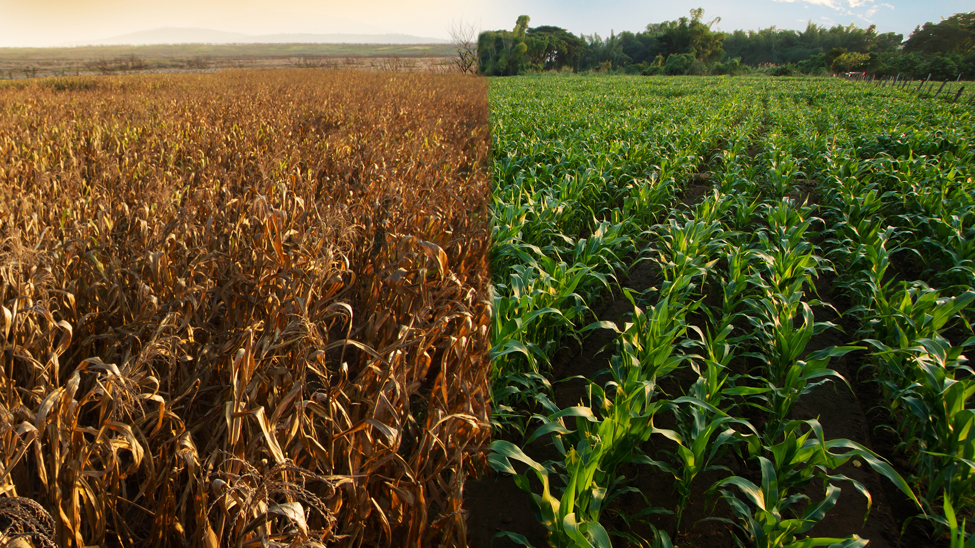
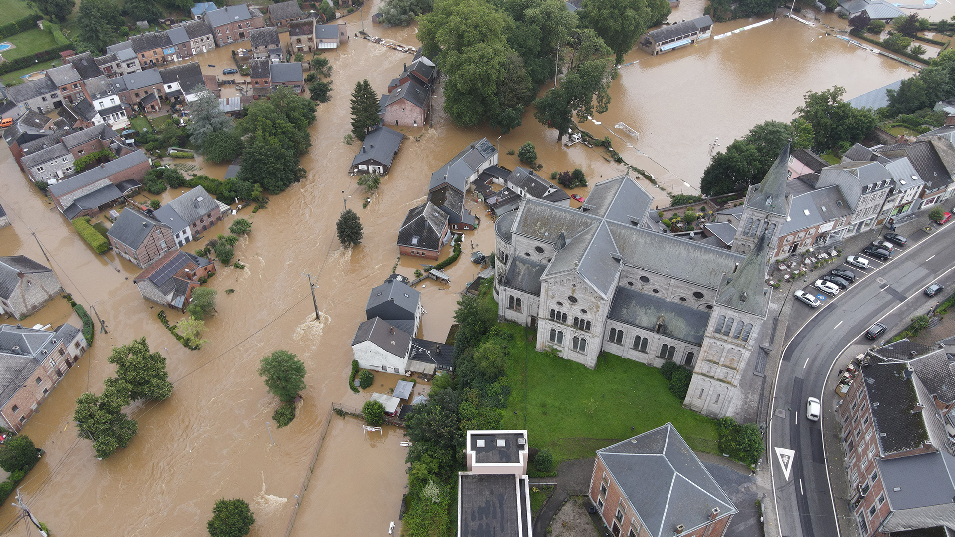
    According to the European Environment Agency (EEA), climate change is causing more extreme weather events in Europe, such as heat waves, droughts, wildfires, and floods. These events are already harming human health, ecosystems, food security, infrastructure, and the economy. The EEA further argues that Europe is not prepared for these growing risks. The agency, therefore, recommends urgent action to reduce greenhouse gas emissions and improve adaptation policies in order to protect Europe from the impacts of climate change.

    Many different types of organisations in various sectors, including RSS-Hydro, are trying to address the many challenges related to the climate crisis by researching and developing solutions that can help governments, public entities, businesses, NGOs, and individuals address some of the challenges and also ensure positive and sustainable impact.

    In order to address the many challenges that climate change brings and to be better prepared and become more resilient to the disastrous floods, landslides, wildfires, and hurricanes that are becoming much more impactful and seemingly more frequent, it is important to collect a lot of data from a variety of observing systems using various sensor technologies.

    Imagine Earth as a huge, complex system. Earth Observation (EO) data is like having a million eyes in the sky, constantly collecting information about our planet. This data comes from satellites and other instruments that measure things like land cover, temperature, precipitation, and soil moisture.

    Now, it is easy to imagine that we would need a very large amount of storage capacity, computing power and really smart algorithms to make sense of this big data and extract useful, actionable information. This is where Artificial Intelligence (AI), particularly Machine Learning (ML), comes in. ML is like having a super-smart brain that can analyse this massive amount of EO data. By looking for patterns and trends, ML can help us understand what is happening on Earth and predict how things might change in the future.

    When focusing on disasters, such as floods and fires, putting EO and ML together, the areas that hold a lot of promise in the near future are:

    • Early warning systems: By analysing EO data, ML can identify areas that are at high risk of floods or fires based on factors like rainfall, temperature, and vegetation. This allows communities to be warned ahead of time and take steps to prepare or evacuate.
    • Better planning: Floodplains and fire-prone areas can be identified using EO data. ML can then analyse this  data to help communities plan development projects in a way that minimises flood and fire risk.
    • Resource management: EO data can be used to monitor water levels and vegetation health. ML can analyse this data to help us manage water resources more effectively and identify areas where fire prevention efforts are most needed.

    Looking closer at flood disasters and flood risk in general, we see that climate change is amplifying flood risks worldwide. To improve our ability to predict and prepare for these events, researchers are exploring advanced techniques like advanced Deep Learning
    and Generative AI.

    A combination of those approaches can be used to look at:

    • Machine Learning for Predictive Analytics: ML algorithms can analyse vast amounts of historical data, including rainfall records, river levels, and land use patterns. This allows them to identify patterns and relationships that can be used to predict the likelihood and severity of future floods.
    • Hybrid Approach with Physics-Based Modeling: Combining ML with traditional physics-based flood models can offer even greater accuracy. These models simulate the physical processes that cause floods, such as precipitation and runoff. By incorporating ML’s data-driven insights, these models can become more adaptable to complex real-world scenarios.
    • Generative AI for Flood Scenario Building: Generative AI, a powerful branch of AI, can create realistic simulations of flood events. Imagine creating ‘digital twins’ of real-world locations – virtual replicas that can be subjected to various flood scenarios. This allows us to explore how different flood intensities would impact specific areas. This advanced form of scenario building fosters a deeper understanding of flood risks, enabling communities to develop more targeted preparedness plans.

    By leveraging these cutting-edge tools, we can move beyond basic flood predictions and toward a future of proactive flood risk management. This will lead to increased resilience and preparedness for a changing climate with heightened flood risks.

    Of all these state-of-the-art approaches, Generative AI, also known as GenAI, holds the most promise, especially in the context of building digital twins.

    Generative AI: Building digital twins for flood preparedness

    Generative AI, offers a revolutionary approach to flood preparedness. It allows us to create ‘digital twins’ – highly realistic simulations of real-world locations. Imagine a virtual replica of your city, complete with buildings, roads, and natural features. This digital twin can then be subjected to various flood scenarios, allowing us to explore the potential impacts of floods with different intensities and durations.

    ai
    © shutterstock/Photon photo

    Simulating flood events:

    • Virtual flood testing ground: Generative AI can create these digital twins by analysing real-world data like satellite imagery, LiDAR scans (which capture 3D terrain data), and geographical information systems (GIS) data. This allows for the creation of incredibly detailed virtual environments that closely resemble real-world locations.
    • Playing out the flood: Once the digital twin is built, we can simulate various flood scenarios. We can adjust factors like:
    • Rainfall intensity: Simulate varying levels of precipitation, from moderate rain to extreme downpours, to see how water levels rise and how different areas are affected.
    • Flood duration: Explore the impact of short-lived flash floods versus prolonged flooding events to understand potential damage and evacuation needs.
    • Visualising the impact: Generative AI can create realistic visualisations of flood simulations. Imagine a video showing how floodwaters would rise and recede, highlighting areas at risk of inundation. This visual representation allows for a much clearer understanding of potential flood impacts compared to traditional text-based reports.

    Benefits of scenario building with Generative AI:

    • Deeper understanding of flood risk: By simulating various flood scenarios, communities can gain a more comprehensive understanding of their specific vulnerabilities. This allows for a more targeted approach to flood preparedness planning.
    • Identifying evacuation routes: Digital twins can be used to identify the most effective evacuation routes under different flood scenarios. This information can be used to develop and optimise evacuation plans, potentially saving lives during a real-world event.
    • Prioritising protection measures: By visualising how different areas are impacted by varying flood severities, communities can prioritise flood protection measures. Resources can be allocated more effectively to reinforce levees, protect critical infrastructure, or mitigate potential damage to vulnerable buildings.
    • Public awareness and education: Realistic flood simulations created by Generative AI can be used to raise public awareness about flood risks. Educating communities about potential flood impacts can encourage residents to take preparedness actions and improve overall community resilience.

    Generative AI offers a powerful tool for proactive flood management. By creating digital twins and simulating various flood scenarios, communities can gain valuable insights and develop more effective flood preparedness plans, ultimately leading to a safer future in the face of increasing flood risks.

    A future of proactive flood management

    The undeniable reality is that climate change is intensifying flood risks across the globe. However, the future is not one of passive acceptance. The tides are turning towards proactive flood management, empowered by innovative technologies like Earth Observation data and Machine Learning.

    earth observation, climate change
    © shutterstock/Alexandru Chiriac_565619365

    By harnessing the power of AI, particularly Generative AI, for building digital twins, communities can move beyond basic flood predictions. These virtual replicas can allow for the simulation of diverse flood scenarios, fostering a deeper understanding of vulnerabilities and potential impacts. This knowledge is the cornerstone for targeted preparedness plans, including identifying evacuation routes, prioritising protection measures, and raising public awareness.

    The fight against climate change’s devastating effects requires a multi-pronged approach. While mitigating emissions remains crucial, advancements like Generative AI offer a promising approach in the face of heightened flood risks. By embracing these
    cutting-edge tools, we can build a future of resilience, one where communities are empowered to face the challenges of a changing climate with more confidence and preparedness.

    In conclusion, it is essential to commend the ongoing efforts of organisations like RSS-Hydro, who exemplify the dedication of countless entities working towards climate solutions. However, effectively mitigating flood risk necessitates a global approach. International collaboration is paramount to ensure the widespread and successful implementation of these innovative technologies.

    Moving forward, collective action is crucial. Individuals can empower themselves by learning more about flood risks in their localities, advocating for proactive flood management policies at all levels, and actively participating in preparedness efforts within their communities. Through collaborative efforts, we can harness the transformative potential of Generative AI and other cutting-edge tools to build a future characterised by resilience in the face of climate change’s escalating threats.

    [ad_2]

    Source link

  • EU launches DestinE system to create a digital twin of Earth

    EU launches DestinE system to create a digital twin of Earth

    [ad_1]

    The European Commission has announced that the initial Destination Earth (DestinE) digital twin system has been activated.

    DestinE is a flagship EU project that will create a digital twin of the Earth to help combat climate change.

    The DestinE system will leverage Europe’s High-performance computers (EuroHPC), such as the LUMI supercomputer in Kajaani, Finland, to simulate extreme weather events and the impacts of climate change.

    This innovative digital twin technology will be pivotal in optimising mitigation and adaptation strategies for growing climate threats.

    The technology was launched today by EU Executive Vice-President Margrethe Vestager and the Finnish Minister for Employment, Arto Satonen.

    Vestager commented: “The launch of the initial DestinE is a true game changer in our fight against climate change. DestinE will provide us with a highly accurate twin of the Earth.

    “It means that we can observe environmental challenges, which can help us predict future scenarios – as we have never done before.

    “This first phase shows how much we can achieve when Europe puts together its scientific excellence and its massive supercomputing power. Today, the future is literally at our fingertips.”

    How does DestinE work?

    DestinE, launched in 2022 by the European Commission, partners with the European Centre for Medium-Range Weather Forecasts (ECMWF), the European Space Agency (ESA), and the European Organisation for the Exploitation of Meteorological Satellites (EUMETSAT).

    Now operational, the system will continuously evolve and, by 2030, should complete a full digital twin of the Earth.

    The initial system features of DestinE include the Core Service Platform, which provides user access to services, tools, and applications.

    It also includes two high-resolution digital twins: one focused on climate change adaptation and another on weather-induced extremes, enabling scenario analysis and testing.

    Additionally, the DestinE Data Lake offers seamless access to data from these digital twins and numerous other sources, including Copernicus, the EU’s Earth observation programme.

    This initiative will enhance Europe’s preparedness for natural disasters, climate change adaptation, and the assessment of potential socioeconomic and policy impacts.

    EU funding support

    The Digital Europe programme has allocated over €315m in funding. The first phase, now complete, and the ongoing second phase, each received over €150m.

    The third phase’s funding will be determined by the final Digital Europe programme for 2025-2027, which is in progress.

    Additionally, Horizon Europe has provided further funding for developing additional digital twin capabilities.

    [ad_2]

    Source link

  • New machine learning technique can detect microplastics

    New machine learning technique can detect microplastics

    [ad_1]

    Optical analysis and machine learning techniques can now readily detect microplastics in marine and freshwater environments using inexpensive porous metal substrates.

    Techniques for detecting microplastics in water samples are essential for environmental monitoring but challenging, in part because microplastics resemble natural organic compounds derived from biofilms, algae, and decaying organic matter.

    Existing detection methods generally require complex separation techniques that are time-consuming and costly.

    The machine learning technique, developed by researchers at Nagoya University with collaborators at the National Institute for Materials Sciences in Japan, overcomes these barriers.

    Separating and detecting microplastics

    “Our new method can simultaneously separate and measure the abundance of six key types of microplastics – polystyrene, polyethene, polymethylmethacrylate, polytetrafluoroethylene, nylon and polyethene terephthalate,” explained Dr Olga Guselnikova of the National Institute for Materials Science.

    The system uses a porous metal foam to capture and detect microplastics optically using a process called surface-enhanced Raman spectroscopy (SERS).

    “The SERS data obtained is highly complex,” said Dr Joel Henzie of NIMS.

    “However, it contains discernible patterns that can be interpreted using modern machine learning techniques.”

    The unique potential of machine learning methods

    To analyse the data, the team created a neural network computer algorithm called SpecATNet.

    This algorithm learns how to interpret the patterns in the optical measurements to detect microplastics more quickly and with higher accuracy than traditional methods.

    “Our procedure holds immense potential for monitoring microplastics in samples obtained directly from the environment, with no pretreatment required, while being unaffected by possible contaminants that could interfere with other methods,” stated Professor Yusuke Yamauchi of Nagoya University.

    The researchers hope their innovation will greatly assist society in evaluating the significance of microplastic pollution on public health and the health of all organisms in marine and freshwater environments.

    By creating inexpensive microplastic sensors and open-source algorithms to interpret data, they hope to enable the rapid detection of microplastics, even in resource-limited labs.

    In addition, the researchers hope to expand the capability of the SpecATNet neural network to detect a broader range of microplastics and even accept different kinds of spectroscopic data in addition to SERS data.

    [ad_2]

    Source link

  • Earth System Models boosted with new computer algorithm

    Earth System Models boosted with new computer algorithm

    [ad_1]

    A scientist from the University of Oxford has developed a new computer algorithm which can be applied to Earth System Models to reduce spin-up time.

    Funded by the Agile Initiative, the scientist tested the models used in UN Intergovernmental Panel on Climate Change (IPCC) simulations.

    The new computer algorithm was shown to be, on average, ten times faster at spinning up the model than currently-used approaches.

    The time taken to reach a stable equilibrium, which is needed for a simulation to run, was reduced from many months to under a week.

    Study author Samar Khatiwala, Professor of Earth Sciences at the University of Oxford’s Department of Earth Sciences, who devised the algorithm, said: “Minimising model drift at a much lower cost in time, and energy is critical for climate change simulations, but the greatest value of this research may ultimately be to policymakers who need to know how reliable climate projections are.”

    The work is published in the journal Science Advances.

    What are the current issues with Earth System Models?

    Earth System Models, essential for forecasting climate change, simulate how Earth’s components interact. They predict future extreme weather and climate events, informing initiatives like the IPCC reports.

    Yet, a key challenge for climate modellers is ensuring model stability. Before simulating the climate after the Industrial Revolution, models must reach equilibrium pre-industrial states. This ‘spin-up’ phase prevents erroneous attributions to human factors.

    However, this process is slow, demanding thousands of model years and up to two years on supercomputers for IPCC simulations.

    About the new computer algorithm

    Professor Khatiwala’s new algorithm uses a mathematical method called sequence acceleration. This equation was later applied by DG Anderson in the 1960s to speed up solutions for Schrödinger’s equation.

    With over half of the world’s supercomputing capacity focused on solving this problem, ‘Anderson Acceleration’ is now a widely used algorithm for it.

    Recognising the iterative nature of both problems, Khatiwala found that Anderson Acceleration could also be used to shorten model spin-up times.

    Using Anderson’s scheme, the final solution is attained more quickly by combining previous outputs into a single input.

    As well as making the spin-up process much faster, the concept can be applied to a huge variety of Earth System Models that are used to investigate and inform policy on a number of climate-related issues.

    Professor Khatiwala is now working with a number of research groups, including the UK Met Office, to trial the new algorithm in their climate models.

    [ad_2]

    Source link

  • UK research advances tsunami warning systems and quantum tech

    UK research advances tsunami warning systems and quantum tech

    [ad_1]

    A collaborative project between the UK and New Zealand is set to create an advanced earthquake and tsunami warning system.

    The £750,000 joint research project will leverage underwater fibre optic cables to improve earthquake and tsunami warning capabilities, an innovation that could benefit millions worldwide.

    The project could revolutionise ocean monitoring, providing coastal communities with extra time to prepare for devastating natural disasters.

    The agreement will be announced at the OECD Committee for Scientific and Technological Policy Ministerial in Paris.

    Additionally, the UK will also announce a partnership with Denmark at the OECD to combine efforts in quantum technology research and innovation.

    UK Science Minister Andrew Griffith said: “Global issues require global collaboration, which is why we need to build more and stronger partnerships on science and research with like-minded nations, just like the ones I am delighted to announce with New Zealand and Denmark today.

    “That shared endeavour is precisely what we will focus on with colleagues from across the OECD to ensure we can all benefit from the improvements to health and wealth that science and innovation promise to deliver.

    “Bringing the UK and New Zealand’s brightest minds together to overhaul how we give crucial advance warning of tsunamis could save thousands of lives.

    “This work proves the value of breakthrough technologies like quantum, and the international teamwork is crucial to harnessing them. The UK’s plans for closer work together on quantum with Denmark reinforces this even further.”

    Why early tsunami warning systems are essential

    Tsunamis, massive waves triggered by underwater earthquakes or landslides, pose a serious threat to coastal communities. Early tsunami warning systems are vital lifelines in these regions, offering precious time for evacuation and preparation.

    Every minute gained is critical, as tsunamis can travel incredibly fast and strike with devastating force. The effectiveness of tsunami warning systems is undeniable.

    Studies show a clear link between early warnings and reduced death tolls. In the aftermath of the 2004 Indian Ocean tsunami, for instance, regions with established warning systems fared significantly better.

    Beyond saving lives, these systems also minimise property damage and economic loss. Timely evacuations allow people to move valuables and secure their homes. This translates to faster recovery and a smoother return to normalcy after the disaster.

    Advancing natural disaster preparedness

    The UK will invest £750,000 via the International Science Partnerships Fund to enable collaboration between UK and New Zealand researchers.

    The project will focus on evolving technology developed at the UK’s National Physical Laboratory (NPL) involving quantum systems.

    The technique utilises telecommunication fibre optic cables already installed in the seabed to detect earthquakes and ocean currents in a method known as optical interferometry.

    © shutterstock/Laiotz

    The initiative will explore whether these cables can accurately provide an early tsunami warning to coastal communities when tremors occur.

    The technology will be trialled between Australia and New Zealand in the Pacific Ocean – an area where earthquakes and tsunamis are common.

    A previous study using a fibre optic cable running almost 6,000 kilometres from the UK to Canada demonstrated the technology’s success.

    Investing in quantum research

    Expanding its global quantum research network, the UK will also solidify its ties with Denmark in Paris through the signing of a Memorandum of Understanding (MoU).

    Denmark’s prominence in quantum research makes it an ideal partner for the UK. Strengthening this collaboration will offer researchers from both nations optimal prospects to engage in groundbreaking projects, particularly in fields like transportation and life sciences.

    Denmark Minister of Higher Education and Science, Christina Egelund, added: “The UK is a very attractive partner in the quantum field, with world-class research environments and great investments.

    “With the new MoU, we are bringing Denmark’s quantum strategy to a higher international level. Quantum technology holds enormous potential to provide us with solutions in virtually every imaginable area, but it requires large investments and strong collaboration.

    “For a small open economy such as Denmark, it is crucial to cooperate with the world’s leading countries. Both when it comes to talent exchange, research, innovation, commercialisation, security and defence.

    “Therefore, I am very pleased that Denmark and the UK will now initiate an even closer collaboration on quantum technology.”

    [ad_2]

    Source link

  • AI weather forecasts can accurately predict the path of major storms

    AI weather forecasts can accurately predict the path of major storms

    [ad_1]

    A new study has suggested that AI weather forecasts can produce predictions of similar accuracy, faster and cheaper than traditional methods.

    The University of Reading study, published in npj Climate and Atmospheric Science, highlights the rapid progress of AI weather forecasts.

    Professor Andrew Charlton-Perez, who led the study, said: “AI is transforming weather forecasting before our eyes. Two years ago, modern machine learning techniques were rarely being applied to make weather forecasts. Now we have multiple models that can produce ten-day global forecasts in minutes.

    “There is a great deal we can learn about AI weather forecasts by stress-testing them on extreme events like Storm Ciarán. We can identify their strengths and weaknesses and guide the development of even better AI forecasting technology to help protect people and property.”

    Comparing AI and physics-based forecasts

    The scientists compared AI and physics-based weather forecasts for Storm Ciarán, which hit northern and central Europe in November 2023. The storm claimed 16 lives in northern Europe and left millions of homes without power in France.

    The researchers used four AI models and compared their results with traditional physics-based models.

    The AI models were able to predict the storm’s rapid intensification and track 48 hours in advance.

    The AI weather forecasts were said to be indistinguishable from the performance of conventional forecasting models.

    They also captured the large-scale atmospheric conditions that fuelled Ciarán’s explosive development, such as its position relative to the jet stream.

    Underestimation of the storm

    However, the machine learning technology underestimated the storm’s damaging winds.

    All four AI forecasting systems underestimated Ciarán’s maximum wind speeds, which, in reality, gusted at speeds of up to 111 knots at Pointe du Raz, Brittany.

    The team showed that the underestimation was linked to some of the storm’s features that the AI systems could not predict well.

    Further investigation of the use of AI is needed

    The researchers argue that further investigation of the use of AI in weather production is urgently needed to protect people from extreme weather events.

    The development of machine learning models could mean that AI weather forecasts will be routinely used in the future, saving forecasters time and money.

    [ad_2]

    Source link

  • European climate risks have reached critical levels, says EEA

    European climate risks have reached critical levels, says EEA

    [ad_1]

    A damning report from the European Environment Agency (EEA) warns that various climate risks across Europe have reached critical levels.

    Europe stands as the fastest-warming continent globally, facing imminent climate risks that threaten multiple sectors, including energy, food security, ecosystems, infrastructure, and public health.

    The EEA’s report ‘European Climate Risk Assessment (EUCRA)’ has issued a dire evaluation, underscoring the critical levels of many risks and the potential for catastrophic outcomes without immediate action.

    Escalating climate risks

    Extreme heatwaves, droughts, wildfires, and flooding, witnessed in recent years, are projected to intensify across Europe, even under optimistic global warming scenarios.

    These phenomena are not only set to exacerbate living conditions but also pose significant threats to various facets of European life.

    The EEA’s report highlights the urgency of identifying policy priorities for climate change adaptation and resilience building in vulnerable sectors.

    © shutterstock/Piyaset

    The assessment reveals that Europe’s policies and adaptation efforts are failing to match the rapid escalation of climate risks.

    Incremental adaptations may prove insufficient, necessitating urgent actions, even for risks not yet deemed critical. Certain regions within Europe emerge as hotspots for multiple risks.

    Southern Europe faces heightened vulnerability to wildfires, heatwaves, and water scarcity, impacting agriculture, outdoor labour, and public health.

    Coastal regions, including densely populated urban areas, confront threats of flooding, erosion, and saltwater intrusion.

    Insights from the risk assessment

    Identifying 36 major climate risks across five clusters—ecosystems, food, health, infrastructure, and economy and finance—the assessment emphasises the pressing need for immediate action.

    More than half of these risks demand urgent attention, with eight deemed particularly critical.

    These include conserving ecosystems, protecting against heat-related health issues, fortifying infrastructure against floods and wildfires, and ensuring the stability of European mechanisms like the EU Solidarity Fund.

    © shutterstock/Great Pics Worldwide

    Ecosystems face urgent risks, especially in marine and coastal areas, with potential cascading effects on food, health, infrastructure, and the economy.

    In terms of food, heat and drought pose critical risks to crop production, particularly in southern and central Europe. Shifting towards plant-based proteins could mitigate water consumption and reliance on imported feed.

    Heat is the most pressing climate risk for human health, impacting vulnerable groups such as outdoor workers, the elderly, and those in poorly built infrastructure. Addressing health risks requires actions beyond traditional health policies, including urban planning and labour laws.

    Infrastructure, including energy, water, and transport systems, is increasingly vulnerable to more frequent and extreme weather events. Coastal flood risks are relatively managed, but rising sea levels and changing storm patterns pose significant threats, especially in southern Europe.

    Europe’s economy and financial system are exposed to various climate risks, including increased insurance premiums, asset threats, and government expenditures.

    The EU Solidarity Fund’s viability is already under strain due to costly floods and wildfires. Worsening climate impacts may exacerbate private insurance gaps and vulnerability among low-income households.

    Collaborative approach needed

    While acknowledging progress in understanding and preparing for climate risks, the EEA report underscores inadequate societal preparedness due to lagging policy implementation.

    It calls for closer cooperation between the EU, its Member States, and regional and local levels to address urgent risks collectively.

    Moreover, bridging knowledge gaps through an improved understanding of climate risks and effective governance structures is deemed crucial.

    Europe’s battle against climate risks is at a critical juncture, demanding immediate and coordinated action across sectors and governance levels.

    The EEA’s assessment serves as a call for policymakers to prioritise climate adaptation and resilience-building measures to safeguard the continent’s future.

    As Europe grapples with escalating risks, concerted efforts towards mitigation and adaptation are imperative to secure a sustainable and resilient future for generations to come.

    [ad_2]

    Source link

  • UK scientists develop new method to track global carbon emissions

    UK scientists develop new method to track global carbon emissions

    [ad_1]

    A recent study conducted by a collaboration of scientists from the University of Exeter, Met Office, and Imperial College has unveiled a novel approach to gauge the total global carbon emissions aligned with the Paris Agreement goals of limiting global warming to 1.5°C and 2°C.

    The research is critical as concerns mount over the Earth’s warming trend. Despite 2023 experiencing temperatures perilously close to breaching the 1.5°C threshold, the Paris targets are concerned with the average temperature rise over a decade or more.

    Lead author Peter Cox, Director of the Global Systems Institute at the University of Exeter, said: “Our study clarifies the climate problem that needs to be solved, and we hope that it will stimulate greater efforts to reduce our emissions to net zero.”

    Understanding global carbon emissions

    Approximately 15 years ago, climate scientists stumbled upon a pivotal revelation about climate change dynamics.

    They discerned that cumulative carbon dioxide emissions predominantly dictate the trajectory of global warming since the onset of industrialisation.

    This breakthrough paved the way for delineating total carbon budgets consistent with the Paris objectives, defining ‘net zero’ as the tipping point where global warming halts.

    Inaccuracies in climate models

    One major hurdle has been the disparities among Earth System Models in predicting the relationship between global carbon emissions and global warming.

    However, the new study circumvents this obstacle through what the authors term an ’emergent constraint’.

    Essentially, this approach entails synthesising data from diverse models to establish a linear correlation between historical global carbon emissions and observed warming, enabling projections of future emissions compatible with Paris targets.

    Encouragingly, the findings suggest emissions budgets that exceed the average values projected by existing models by at least 10%.

    However, the reality remains that if current emission rates persist, humanity has just over a decade before breaching the 1.5°C threshold delineated by the Paris Agreement, even when considering decade-long averages of warming.

    Co-author Chris Jones, from the Met Office, added: “This emergent constraint is elegant and powerful. It uses observations to narrow the possible range of future emissions, but it also lets us consider other greenhouse gases other than just CO2. In this way, the remaining carbon budget is made much more policy relevant.”

    As the world grapples with the imperative to curb global carbon emissions and mitigate climate change, the insights from this study offer a roadmap for policymakers and stakeholders.

    Urgent action is warranted to align our carbon trajectory with the Paris goals and avert the most catastrophic consequences of climate change.

    [ad_2]

    Source link

  • Innovative solutions to environmental and sustainability challenges

    Innovative solutions to environmental and sustainability challenges

    [ad_1]

    Donna Lyndsay, Strategic Market Lead for Sustainability at Ordnance Survey, discusses how geospatial innovations are working to overcome sustainability challenges.

    COP28 drove home some of the critical needs for innovative solutions to help drive transparency and trust into solving sustainability challenges and investments and how Big Data and climate monitoring will be vital in helping the transition.

    Without visibility of where things are, we cannot understand corporate and government impact or how to address sustainability challenges locally.

    Also, to help frame citizen support for the change needed, Sustainable Development Goals (SDGs) are now, more than ever, being seen as a useful and recognised framework to support transitions valued by citizens based on matching value sets with corporate actions.

    How are sustainability challenges being overcome?

    The Supply Chain Data Partnership (SCDP), of which OS is a founding member, was established at COP27 to develop and provide critical location insights for assurance of global supply chains.

    One year later, the SCDP reached a major milestone in developing a proof of concept for a trusted location platform to overcome sustainability challenges. Location is the key component of the register, allowing the identification and verification of where assets such as farms, sites, and facilities are, with follow-up monitoring over time. Data and certificates associated with each verified asset owner will then sit on the new register, meeting global registry standards.

    This will be accessible to buyers and investors, who can make better decisions in their procurement, reducing risk and enabling assessment of impact and opportunity. The SCDP wants to hear from businesses interested in how the register can support their SDGs.

    This solution is now linked with an inspirational, ambitious, and influential initiative that, at a higher level, aims to enable the government, financial services, and companies to understand how to encourage, support, and verify sustainable supply chains worldwide.

    Geospatial initiatives following COP28

    Following COP28, a new coalition known as ‘The Constellation’ was announced by Rewired Earth and Bankers for Net Zero and was supported by more than 40 entities, including OS.

    geospatial initiatives
    © shutterstock/Parilov_

    This new forward-leaning organisation wants to transform financial markets into the most protective force on the planet by driving transparency throughout global supply chains and sustainability investments using the SDG framework.

    In the meantime, in Yorkshire, pioneering geospatial technology is helping to monitor the restoration of the nation’s peatlands. Peatlands are the largest natural carbon store on land, storing more carbon than is currently in the global atmosphere, and have a net cooling effect on climate change.

    Natural England wants to prevent further loss of peatland habitats, re-wetting peatland areas and returning them to their natural state, which in turn could make a significant contribution to overcoming sustainability challenges and reaching net zero by 2050, as well as improving water quality, reducing flood risk, and supporting biodiversity.

    Working with Natural England and scientists from Durham University, a new monitoring and verification service called OS VeriEarth®, built on OS’s deep expertise in objective data collection, curation and change detection, is combining satellite and ground-based data with location intelligence to create and visualise a baseline of the peatlands habitat in a target location.

    The data is presented on a dashboard to enable Natural England to assess site conditions and monitor changes across a large site area. The service can record different types of vegetation species, provide reporting on vegetation cover linked to greenhouse gas emissions and monitor the water table.

    There is enormous potential for this baseline and monitoring technique to be rolled out nationwide to increase and validate investment for large-scale peatland restoration projects, from carbon offsetting or carbon credits, and to help protect against greenwashing claims.

    In another innovative use of Earth Observation data, CGI developed a water pollution predictive tool to detect sewage overspill events remotely from space. This falls under the umbrella of CGI’s Sustainability Exploration Environmental Data Science (SEEDS) programme, a research initiative designed to challenge the thinking and practice around sustainability challenges in partnership with academia, launched with the United Nations in 2022.

    The project will utilise a newly created Artificial Intelligence (AI) model that can accurately predict the conditions most often associated with pollution events and provide a proactive approach to environmental management and nature protection in the North Devon UNESCO Biosphere Reserve.

    The biosphere covers 55 square miles and is centred on Braunton Burrows, England’s largest sand dune system. The project is in its second phase, where OS tests AI outputs against real-world sensor data. If proven successful, the solution is designed to be scalable to effectively target scarce resources, helping reduce water pollution, rebalance the system back to favourable conditions, and enable nature to recover.

    Humans may have created many of the problems we face. Still, we have all the creativity and technology to become the solution, enabling us to adapt to sustainability challenges and letting nature do what she does best: adapt and thrive.

    [ad_2]

    Source link

  • PACE mission successfully launches to measure climate health

    PACE mission successfully launches to measure climate health

    [ad_1]

    NASA’s PACE mission has successfully launched into orbit, ushering in a new era of cutting-edge climate monitoring.

    The space agency’s latest satellite mission, named PACE (Plankton, Aerosol, Climate, ocean Ecosystem), embarked on its journey into space at 1:33 am EST on Thursday, marking a significant milestone in the study of ocean health, air quality, and climate change.

    Launched aboard a SpaceX Falcon 9 rocket from Space Launch Complex 40 at Cape Canaveral Space Force Station in Florida, the PACE satellite confirmed signal acquisition just five minutes after liftoff, with the spacecraft performing as expected.

    Jeremy Werdell, a PACE project scientist, explained the significance of the mission: “After 20 years of thinking about this mission, it’s exhilarating to watch it finally realised and to witness its launch. I couldn’t be prouder or more appreciative of our PACE team.

    “The opportunities PACE will offer are so exciting, and we’re going to be able to use these incredible technologies in ways we haven’t yet anticipated. It’s truly a mission of discovery.”

    Credit: NASA

    PACE: Understanding the effects of climate change

    The PACE mission holds particular significance in understanding climate change’s effects on phytoplankton, crucial organisms in the global carbon cycle.

    Phytoplankton absorb carbon dioxide from the atmosphere, playing a pivotal role in regulating Earth’s climate. With climate change causing shifts in ocean temperatures and chemistry, studying phytoplankton dynamics becomes imperative.

    PACE will provide researchers with valuable data to monitor and assess these changes, helping to predict the health of fisheries, track harmful algal blooms, and detect shifts in marine environments.

    Studying microscopic life in water and air particles

    Operating hundreds of miles above Earth’s surface, the PACE mission is dedicated to studying the impact of minute, often invisible entities such as microscopic life in water and particles in the air.

    The satellite is equipped with a hyperspectral ocean colour instrument, allowing researchers to observe oceans and water bodies across various light spectrums, from ultraviolet to near-infrared.

    This capability enables the identification and tracking of phytoplankton communities globally on a daily basis, a first-ever achievement from space.

    In addition to the ocean colour instrument, the spacecraft carries two polarimeter instruments, Hyper-Angular Rainbow Polarimeter #2 and Spectro-polarimeter for Planetary Exploration.

    These instruments will provide vital data on how sunlight interacts with atmospheric particles, offering insights into atmospheric aerosols, cloud properties, and air quality at local, regional, and global levels.

    By combining these instruments, PACE aims to unravel the intricate interactions between the ocean and atmosphere, shedding light on how a changing climate impacts these systems.

    Contribution to global food security and economy

    The research conducted through the PACE mission will have far-reaching implications for various aspects of human life.

    Phytoplankton-driven ecosystems support critical resources for food security, recreation, and the economy.

    By understanding how climate change affects these ecosystems, scientists can better prepare for and mitigate its impacts, safeguarding these vital resources for future generations.

    As the PACE satellite begins its mission, NASA anticipates groundbreaking discoveries that will deepen our understanding of Earth’s interconnected systems and pave the way for informed climate action.

    [ad_2]

    Source link