




It’s well known that where there’s smoke there’s fire, but did you know that where there’s rain there’s ice?
Or so the conventional thinking goes, as atmospheric ice crystals allow raindrops to grow large and heavy enough to fall from cold clouds.
There are also ‘warm clouds’, which generate much of Earth’s rain, especially in the tropics, and influence our global energy balance.
Yet how raindrops form inside these sky-borne marshmallows made of water is one of the biggest puzzles in atmospheric science – and a barrier to precise climate forecasts.
Fortunately, scientists have just taken a significant step toward solving this mystery, revealing the previously invisible structures that breed raindrops in warm clouds.
As reported in a recent study in PNAS, researchers from the Max Planck Institute for Dynamics and Self-Organization (MPI-DS) used their unique, in-house CloudKite – a helium-filled balloon-kite – to probe low-flying cumulus clouds near Barbados.
“We assessed the structure of a warm cloud at high spatial resolution,” says Mohsen Bagheri, a cloud microphysics and atmospheric turbulence researcher and the study’s senior author.
Unlike using planes, which zoom by and gather fewer measurements that may be separated by miles, or drones, which have limited flight times and may cause turbulence, CloudKite is “like a 3D-microscope in the clouds investigating particle size and distribution”, Bagheri explains.
It sports two bespoke optical imaging systems that combine the cloud-scanning benefits of lasers and high-speed cameras.
As a result, CloudKite can create 3D representations of the position and size of droplets in clouds, capturing data at a rate of 75 times per second to map cloud dynamics on scales from micrometers to kilometers.
Yet our understanding of cloud microphysics is still incomplete, “exemplified by our inability to fully explain how rain initiates in warm clouds” the researchers say, “which is an unsolved mystery that has puzzled scientists for many decades”.
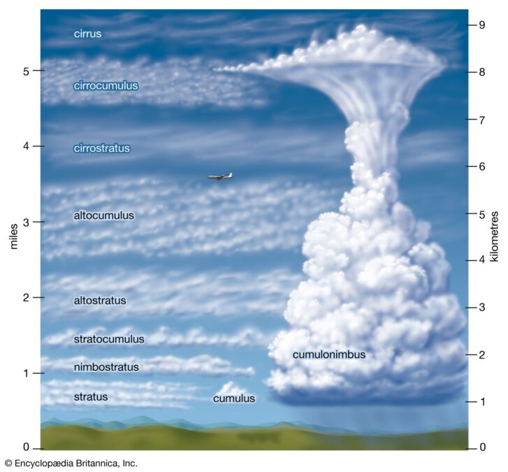
So the researchers sought to demystify its major mystery: the bottleneck that would-be raindrops must overcome.
For a tiny droplet, at the limit of human vision, to become a full-fledged falling raindrop, it must collide and combine with its fellows, growing heavy enough to fall from the sky (and, annoyingly, onto our freshly cleaned cars).
Now, researchers have uncovered this invisible process, demonstrating that cloud droplet clustering occurs in highly intermittent, ultra-localized hotspots, rather than uniformly or randomly throughout clouds.
In reality, most of a sampled cloud may not harbor significant clustering. Instead, it appears to occur in small patches spanning a meter (3.3 feet) or less, in which individual droplets are packed shoulder-to-shoulder at separations of only around one millimeter (0.04 of an inch).

“Because droplets cluster there, collisions become much more likely,” says Birte Thiede, a cloud microphysics researcher and the study’s first author.
“These localized hotspots may therefore represent the places where rain starts in shallow cumulus clouds.”
In contrast, previous research suggested that clustering is weaker and more spread out in shallow (low) stratocumulus clouds. This may be because other observatories could not match CloudKite’s ability to resolve localized clusters, and instead averaged out their signals across much larger areas.

Though this may seem a neat resolution to the clustering mystery, the researchers note that the hotspots may not clearly correlate with droplet concentrations or average sizes.
Instead, they may be facilitated by dynamical factors like turbulence, which the team is currently studying.
Such factors affect how cloud components evolve and coalesce into raindrops, dictating both Earth’s water budget and its energy balance, as clouds are vital for reflecting, absorbing, and emitting solar radiation.
Related: Organized Megastorms Could Reshape Tropics’ Rainy Seasons In The Coming Years
Accordingly, future CloudKite expeditions are in the works, including flights over the Amazon, the Baltic Sea, and Finland.
Constraining hotspot formation, the droplets’ collision rates, and how they join together will be essential to ironing out some sizable wrinkles in climate simulations, promising that you’ll never get caught in a hairdo-ruining downpour without an umbrella again.
As Bagheri concludes, revealing the “hidden structure of warm clouds will lead to better descriptions of rain formation and more accurate weather forecasts”.
This research was published in PNAS.
This article was fact-checked by Rachel Garner and edited by Peter Dockrill. While we pride ourselves on our process, we are only human. If you spot a mistake, please let us know.